MIT Visualizing Cultures
MIT Visualizing CulturesMenu
Go back to the Essay
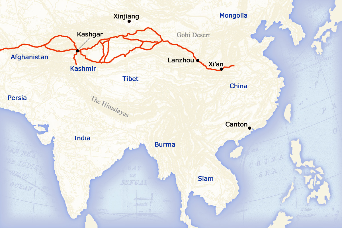
The overland network of trade routes through central Eurasia, known as “silk routes,” is shown in red on the map at right. These land routes had flourished since the Han dynasty (206 BC to 220 AD), but in the 13th century the economic importance of sea travel began to grow. A large amount of global trade finally shifted from the silk routes to faster and cheaper sea routes during the 18th century. (The countries shown on the map are 19th-century political entities.)


[silk_routes.jpg]
The Silk Routes
of Central Eurasia
On viewing images from the historical record: click here.
Massachusetts Institute of Technology © 2009 Visualizing Cultures
Creative Commons - some rights reserved
Tweet
Rise & Fall of the Canton Trade System I
Units
China in the World
MIT Visualizing Cultures VC Units MIT Visualizing Cultures About VC VC Scholars Partner Institutions Outreach Conferences & Events Contact Join Us Follow Us Units Icon View Text View Curriculae China and the World Trade with the West Commodities Merchants The Artists' Narrow World Sources
 & Resources Rise & Fall of the Canton Trade System Macau &  Whampoa Anchorage Canton & Hong Kong Image Galleries Curriculum