Rise & Fall of the Canton Trade System Gallery: PLACES / cwC_1840_AH64115_Map |
cwC_1840_AH64115_Map.jpg
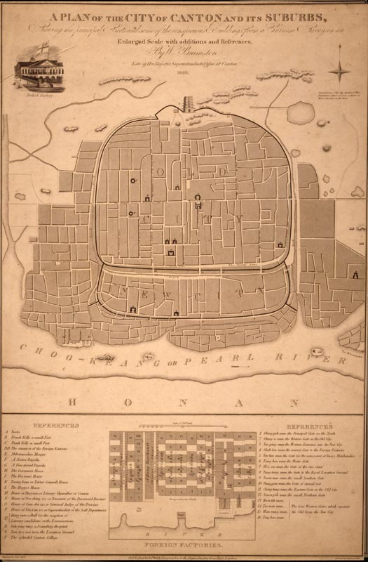
A Plan of the City of Canton and its Suburbs Shewing the principal Streets and some of the conspicuous Buildings from a Chinese Survey on an Enlarged Scale with additions and References, by W. Bramston, Late of Her Majesty’s Superintendents Office at Cant
Map of Canton, 1840
On viewing images of a potentially disturbing nature: click here. |
Massachusetts Institute of Technology © 2009 Visualizing Cultures |