Rise & Fall of the Canton Trade System Gallery: PLACES / cwBTW_1847_AH6439311_Map |
cwBTW_1847_AH6439311_Map.jpg
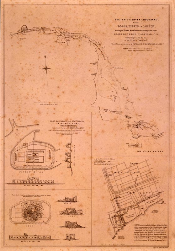
Text: Sketch of the River Chou-Kiang. from the BOCCA TIGRIS to CANTON. Shewing the FORTS, &c. taken by the Forces employed under Major General D'Aguilar, C.B. Commanding in China, &c. &c. on the 2nd and 3rd April 1847 Compiled from various sources by Capt
Map of the Pearl River Delta, 1847
On viewing images of a potentially disturbing nature: click here. |
Massachusetts Institute of Technology © 2009 Visualizing Cultures |