MIT Visualizing Cultures
MIT Visualizing CulturesMenu
Go back to the Essay
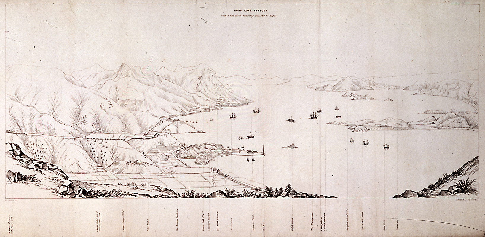
“Hong-kong bay is one of the finest which I have ever seen: it is eight or ten miles in length, and irregular in breadth...having excellent anchorage all over it, and perfectly free from hidden dangers. It is completely sheltered by the mountains of Hong-kong on the south, and by those of the mainland of China on the opposite shore; land-locked, in fact, on all sides; so that the shipping can ride out the heaviest gales with perfect safety.” —Robert Fortune


Map of Hong Kong harbor, 1845
[cwHK_1845_AH8429_Harbor]
Map of Hong Kong harbor above Causeway Bay, 1845
On viewing images from the historical record: click here.
Massachusetts Institute of Technology © 2009 Visualizing Cultures
Creative Commons - some rights reserved
Tweet
Rise & Fall of the Canton Trade System III
Units
Essay
MIT Visualizing Cultures VC Units MIT Visualizing Cultures About VC VC Scholars Partner Institutions Outreach Conferences & Events Contact Join Us Follow Us Units Icon View Text View Curriculae Canton & Hong Kong Canton Trade Canton Happenings End of the Canton System Hong Kong Sources
 & Resources Rise & Fall of the Canton Trade System China in the World Macau &  	Whampoa Anchorage Image Galleries Curriculum