MIT Visualizing Cultures
MIT Visualizing CulturesMenu
Go back to the Essay
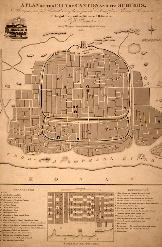
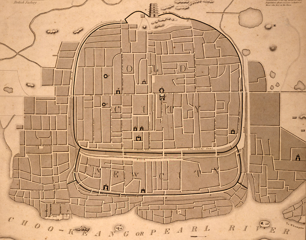
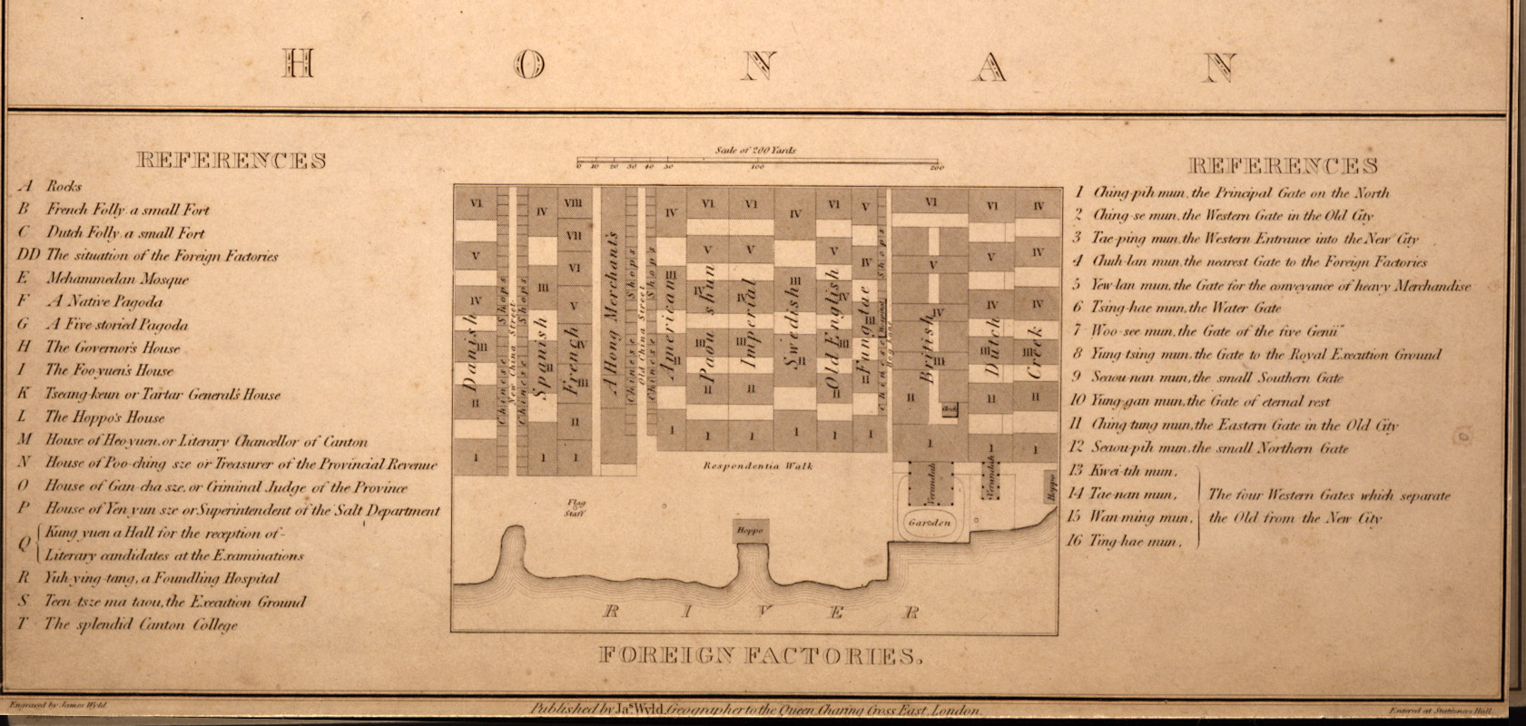
This map shows the city walls, “Old” and “New City,” the “Five-Storey Watchtower” at the top, and the river with both Chinese and English names “Choo-Keang or Pearl River” at the bottom. The text reads: “A Plan of the City of Canton and its Suburbs Shewing [sic] the principal Streets and some of the conspicuous Buildings from a Chinese Survey on an Enlarged Scale with additions and References, by W. Bramston, Late of Her Majesty’s Superintendents Office at Canton, 1840.”


Hong Kong Museum of Art [cwC_1840_AH64115_Map]
British Map of Canton, 1840
On viewing images from the historical record: click here.
Massachusetts Institute of Technology © 2009 Visualizing Cultures
Creative Commons - some rights reserved
Tweet
Rise & Fall of the Canton Trade System III
Units
China in the World
MIT Visualizing Cultures VC Units MIT Visualizing Cultures About VC VC Scholars Partner Institutions Outreach Conferences & Events Contact Join Us Follow Us Units Icon View Text View Curriculae Canton & Hong Kong Canton Trade Canton Happenings End of the Canton System Hong Kong Sources
 & Resources Rise & Fall of the Canton Trade System China in the World Macau &  	Whampoa Anchorage Image Galleries Curriculum