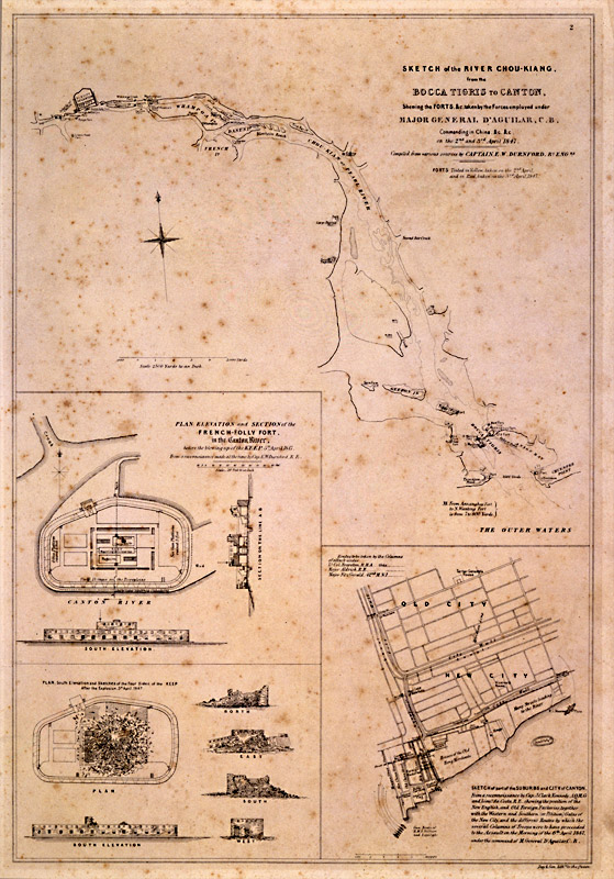
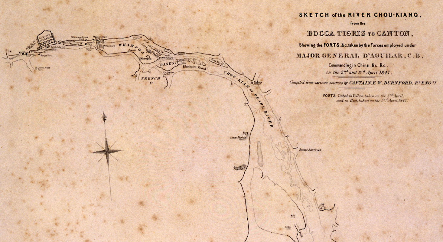
The text of the map at right reads "Sketch of the River Chou-Kiang. from the BOCCA TIGRIS to CANTON.
Shewing the FORTS, &c. taken by the Forces employed under Major General D'Aguilar, C.B.
Commanding in China, &c. &c.
on the 2nd and 3rd April 1847.
Compiled from various sources by Captaine E. W. Durnford, R'd Eng.
Forts Tinted in Yellow, taken on the 2nd April.
and in Red, taken on the 3rd April, 1847."
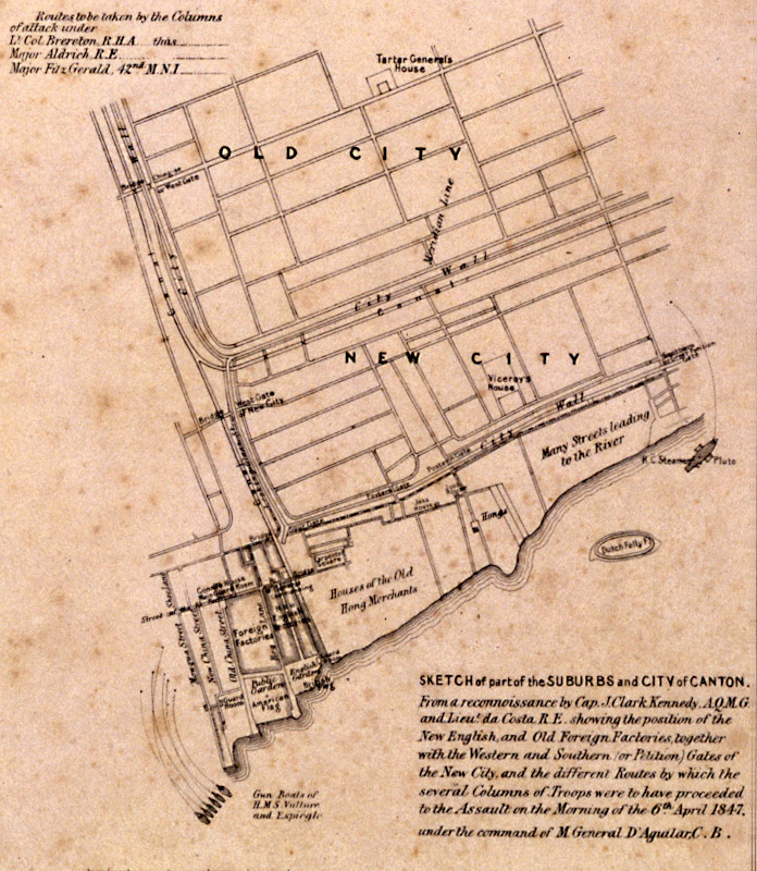
Map of the Pearl River Delta, 1847
[cwBTW_1847_AH6439311_Map]
Map of the Pearl River
Delta, 1847