| |
18 Sites in Koizumi’s Tokyo |
|
| |
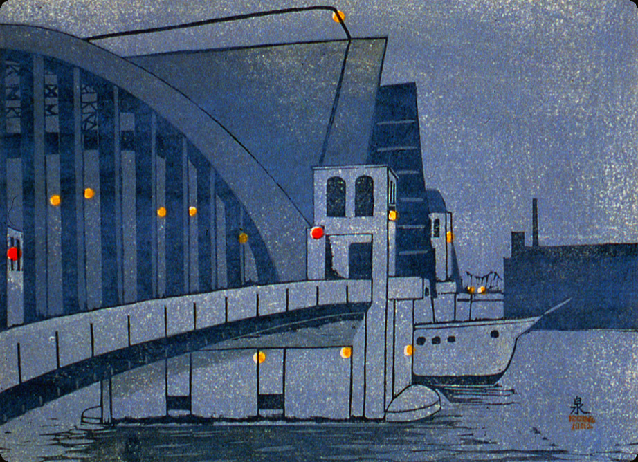
New Kachidoki Bridge (#20-revised), no date
“In modern times this ferry crossing was replaced by a modern drawbridge.”
(Koizumi’s annotation, 1940)
The drawbridge was completed in 1940. Kachidoki, “shout of triumph,” refers to Japan’s victory over Russia in 1905, the year that ferry service was established to link Tsukiji and Tsukishima, 3,500 acres of reclaimed land facing Tokyo Bay. In anticipation of the Twelfth Olympic Games, to be held in Tokyo in 1940, Tsukishima was designated as the site of an enormous sports complex, with indoor and outdoor facilities covering 600 acres.
View more bridges in Pathway 01: Bridging the City |
|
 |
| |
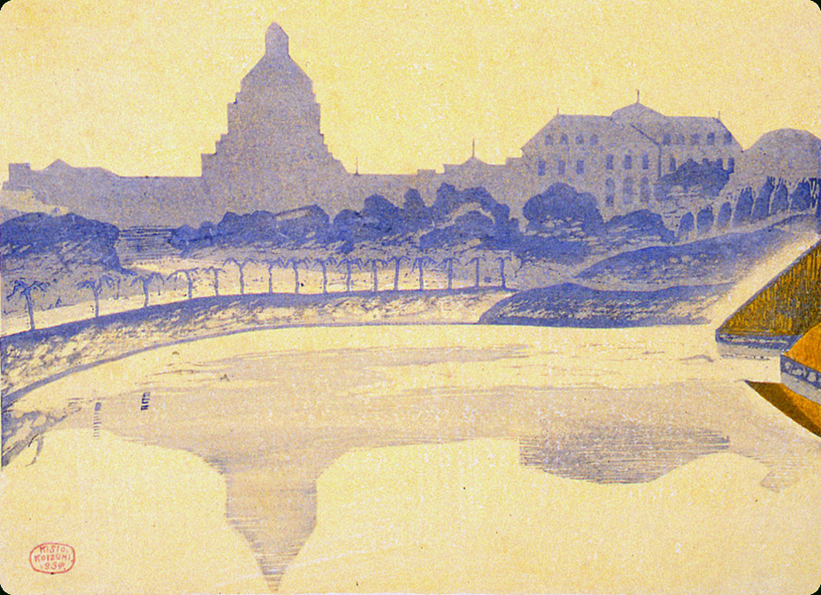
Senju Town with Storage Tanks (#4), June 1929
“This work was well received and its ‘left wing’ style was a source of comment.”
(Koizumi’s annotation, 1940)
The starkly modern feel of this print depicting oil storage tanks may have prompted Koizumi’s comment, which was ironic given the decidedly bourgeois thrust of his celebration of the “new Tokyo.”
View more technological development in Pathway 02: Infrastructure |
|
 |
| |
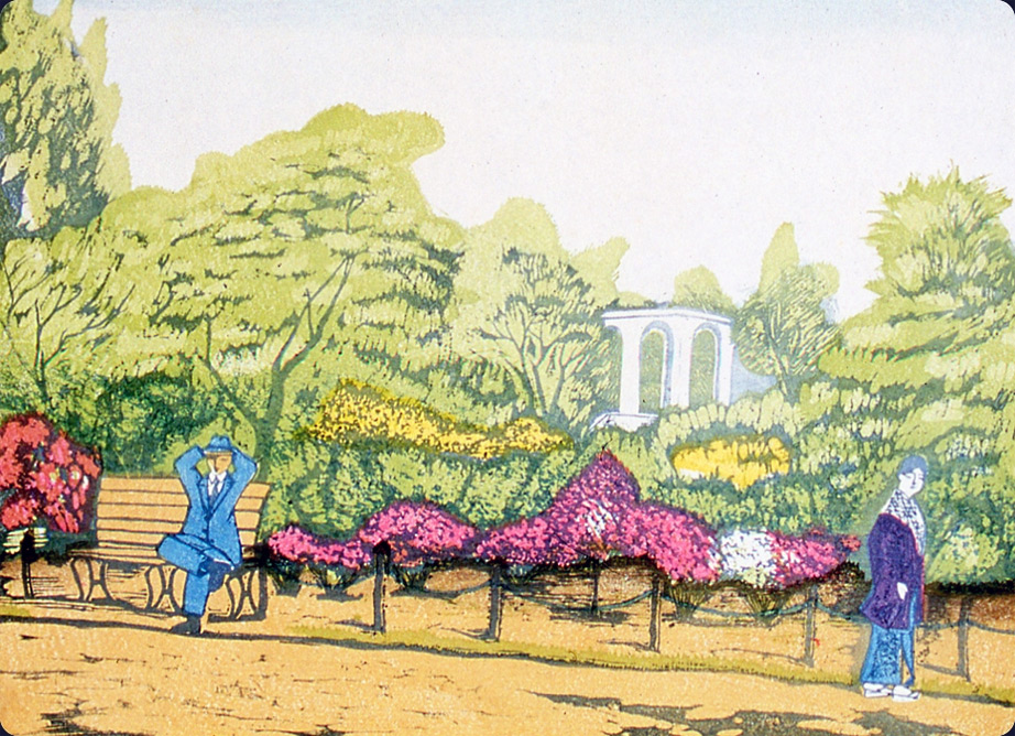
Hibiya Park with Fresh Leaves and Azalea Blossoms (#5), July 1930
“The fresh green leaves and blossoming azaleas were strikingly beautiful. The addition of a few human figures was oddly effective.” (Koizumis annotation, 1940)
Hibiya Park, Japan’s first Western-style park, was opened in June 1903. The music hall built after the earthquake typically featured Western band music, often played by a brass band from the army. After World War Two, the benches in this area were a meeting place for lovers. At the time of the print, however, police would intercept a couple just for walking together. That’s why men and women were drawn separately.
Explore the many images of nature in Pathway 03: Parks & Public Spaces |
|
 |
| |
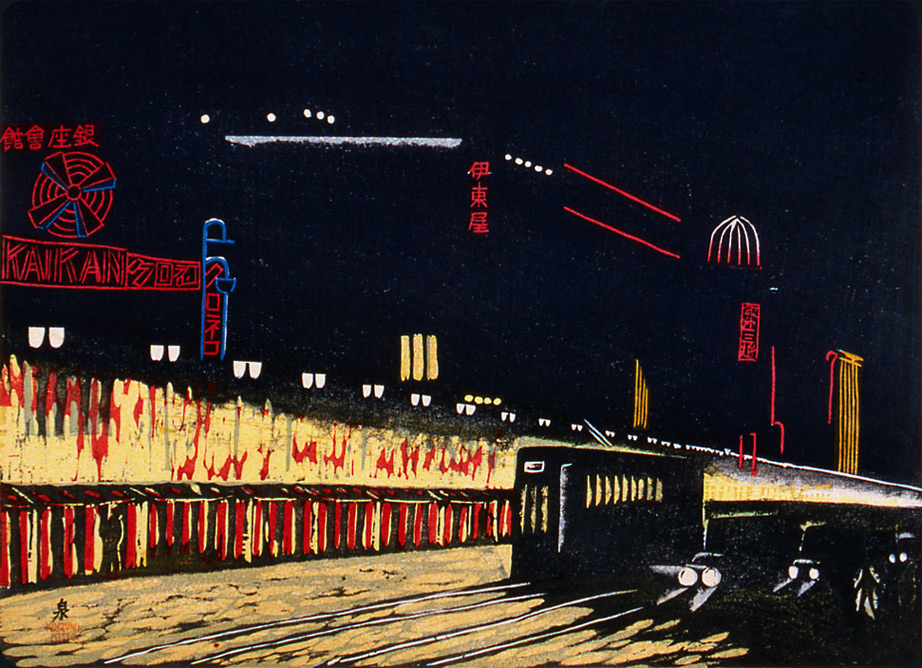
Night View of Ginza in the Spring (#12), March 1931
“An evening during the era of dazzling illumination.” (Koizumi’s annotation, 1940)
Electric advertising signs and the headlights of streetcars and automobiles pierce the darkness, proclaiming the city's progress. With the completion of the Shimbashi railroad terminal in 1872, Ginza served as the gateway to Tokyo from the south and west. Over the next 50 years it was transformed into a fashionable commercial area with wide streets, gaslights, sidewalks, and a tramway. The 1923 earthquake completely leveled the area's shops, department stores, restaurants, and cafés. By 1930, the Ginza district was entirely rebuilt, doubling its pre–1923 size.
Explore Tokyo after dark in Pathway 04: City Lights |
|
 |
| |
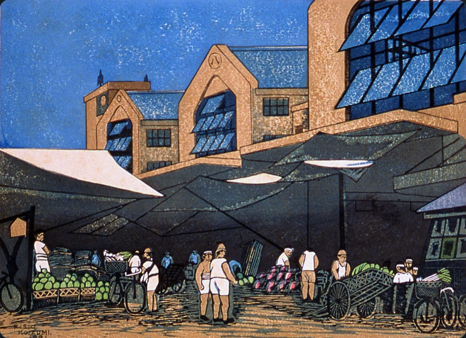
Vegetable Market at Kanda (#16), September 1931
“Vegetables for all of Tokyo were distributed from this place.” (Koizumi’s annotation, 1940)
Damage from the earthquake required the reconstruction of Tokyo's wholesale food markets, including the Central Wholesale Market at Tsukiji (completed in 1931) and branch markets in Kanda and Kōtō (completed in 1930). Vegetable sales were transacted under tented stalls along the Kanda River to facilitate the shipping of goods. In Koizumi's view, the massive reinforced concrete-and-glass warehouse—built to withstand future earthquakes and fires—dwarfs the workers and their old-fashioned, manually operated bicycles and carts.
View working-class activities in Pathway 05: Labor |
|
| |
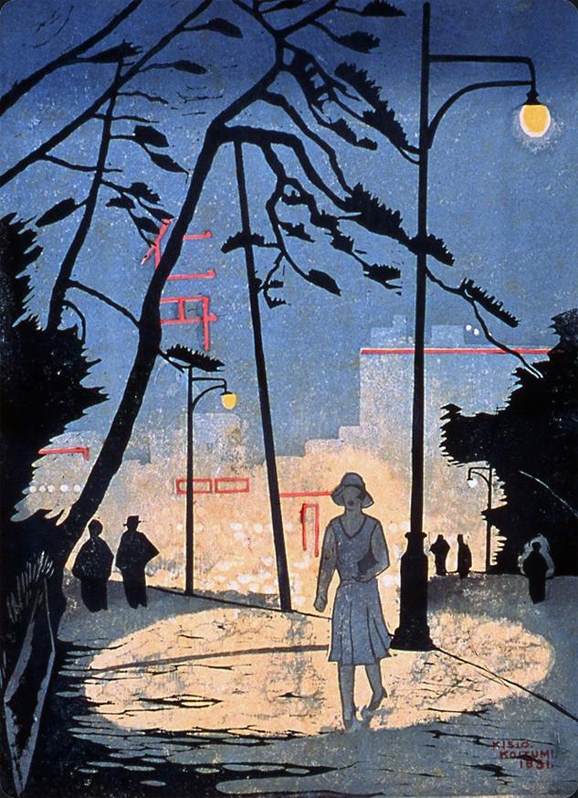 |
 Yamashita Entrance to Ueno Park (#17), September 1931 Yamashita Entrance to Ueno Park (#17), September 1931
“In the era of the shoguns, the Black Gate stood at this site. The remaining pines do not comment on this.”
(Koizumis annotation, 1940)
Ueno, Tokyo's great public park, incorporated religious, civic, and cultural sites. In September 1923, Yamashita became the location of an enormous refugee camp for displaced citizens of Tokyo. The stylish young woman shown walking alone at night under an electric streetlight might be Koizumi's way of inviting comparison between the peaceful and safe aspects of the new Tokyo and the turmoil wrought by the earthquake.
See the variety of women portrayed by Koizumi in Pathway 06: Women in the City |
| |
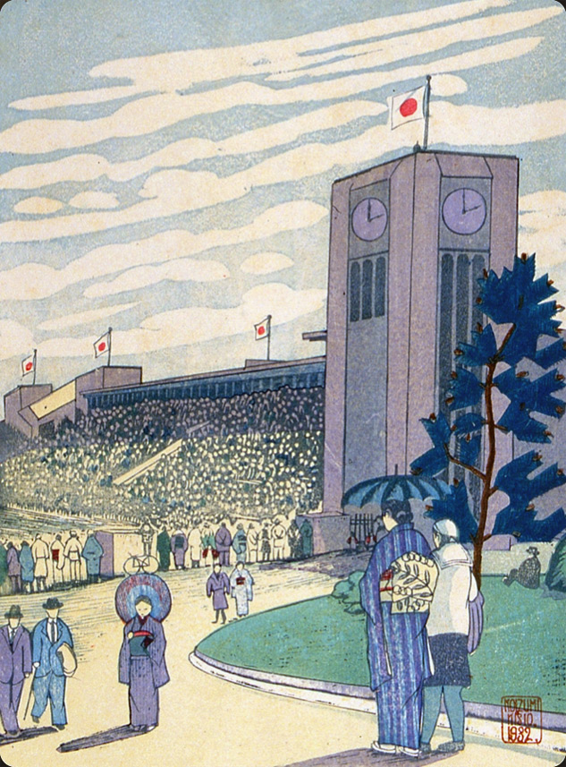 |
May Sports Season at Meiji Shrine Outer Gardens (#27), May 1932
(There is no annotation from Koiizumi for this print, which was replaced by a revised version.)
Japan’s presence on the world stage did not stop at politics. The Japanese took immense pride in their emerging athletic prowess and increased ability to compete successfully with Western countries. The sports complex at Meiji Shrine, known as the “sports center of the Orient,” included this stadium constructed in 1920 and a baseball stadium constructed in 1926 and enlarged in 1931 to accommodate up to 57,000 spectators. The grounds of the Meiji Outer Garden also contained the largest competition swimming pool in Japan, completed in 1931, with a 13,000-spectator capacity. Only two Japanese athletes attended the 1912 Olympic Games in Stockholm. By 1928, Japanese athletes had won two competitions. At the 1932 Olympic Games in Los Angeles, Japan won seven competitions, and radio station JOAK aired live broadcasts of the action from Los Angeles.
Explore sporting life in Pathway 07: Sports & Recreation |
 |
| |
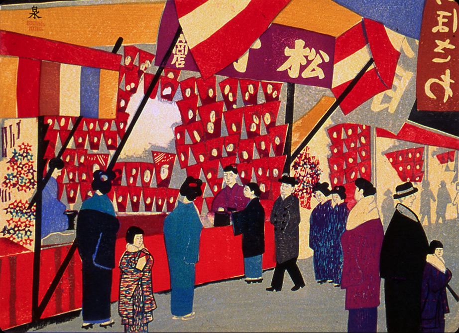
Hagoita [Battledore] Fair at Yawata Shrine, Fukagawa (#74), December 1935
“This hagoita (battledore) festival at Kaminari Gate as well as the hagoita festival at Fukugawa Yawata are year-end events especially popular with young girls.” (Koizumi’s annotation, 1940)
The Hagoita-Ichi (Battledore Fair) takes place at the end of the year. Originally, battledores were used to play the game hanetsuki, which is similar to badminton with a shuttlecock. The decorative paddles became associated with dispelling bad luck.
Visit celebrations in Pathway 08: Festival & Festivities |
|
| |
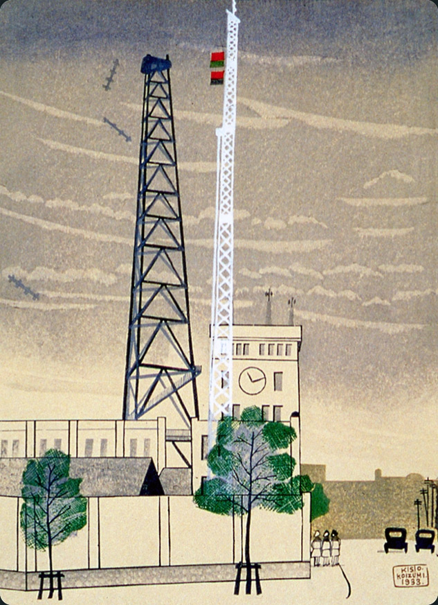 |
The Central Meteorological Observatory (#41), September 1933
“This is the place where they forecast the weather, sometimes correctly and sometimes not.” (Koizumi’s annotation, 1940)
Koizumi’s caption was a wry reminder of the 1923 earthquake.
Explore Pathway 09: Air & Airwaves |
| |
The New Diet Building (#45), February 1934
“Late on a winter’s day the new Diet Building shimmers like a mirage in a golden haze.”
(Koizumi’s annotation, 1940)
The 1890 Meiji Constitution established a modern constitutional monarchy with a two-chamber Diet, or parliament. By the mid–1920s, Japan had introduced universal male suffrage. In 1918, a government-sponsored competition for the design of a permanent Diet building received 118 submissions, and the resultant building reflected a combination of ideas submitted by several entrants. The Diet, with its popularly-elected lower house, continued to function through World War Two.
See how water pervaded views of Tokyo in Pathway 10: Water & Waterways |
|
| |
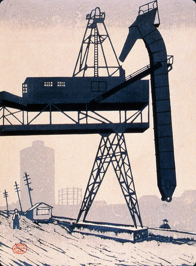 |
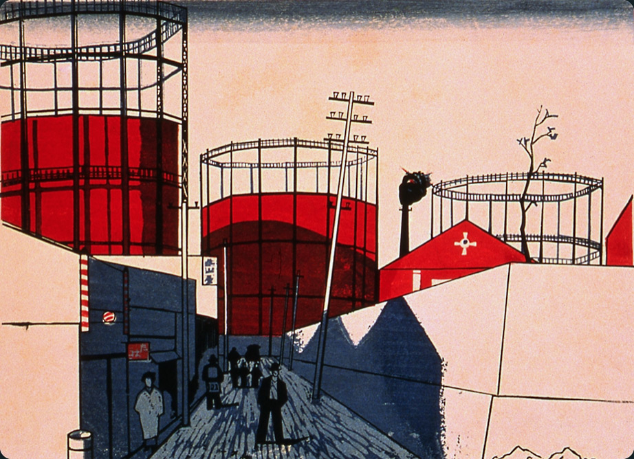
View of Sunamachi [Jōtō Ward] (#54), July 1934
“Jōtō Ward is an industrial area. This is in the vicinity of the gas company.” (Koizumi’s annotation, 1940)
Jōtō ward was a new ward created after the earthquake. The area previously supplied vegetables and seafood to Tokyo, but gradually became industrialized and Koizumi’s print in some way reflects Japan’s transition from an agricultural to industrial economy.
See industrial structures in Pathway 11: Steel & Stone |
| |
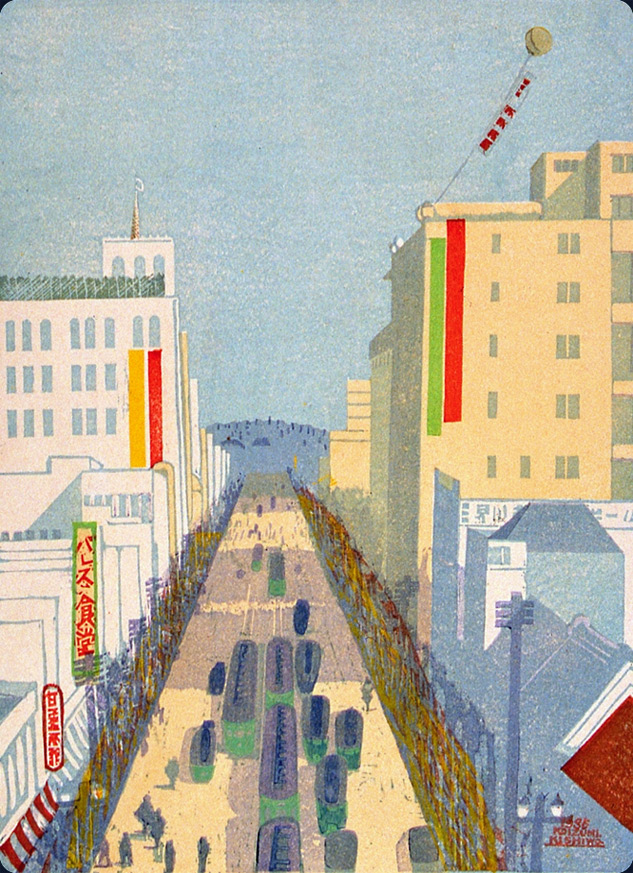 |
Street at Shinjuku (#61), April 1935
Yodobashi, Suginami and Nakano are the fashionable places for the intellectual class to gather.” (Koizumi’s annotation, 1940)
What Koizumi did not mention is that the bustling avenue in this print terminates at what all Tokyo residents would recognize to be the Hanzomon gate of the Imperial Palace. Unobtrusively, the imperial presence oversees the prosperity of the nation.
Explore the imperial presence in Pathway 12: Imperial Places |
| |
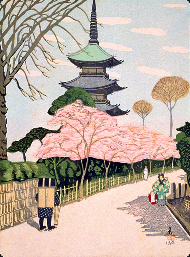 |
Pagoda of Tennōji Temple at Yanaka (#78), May 1936
“Tradition relates that the shogun Yoritomo discovered a spring at this site. The municipality has designated this place as an official scenic site.” (Koizumi’s annotation, 1940)
In this evocation of the past in the present, Koizumi’s allusion reaches all the way back to the late 12th century and famous samurai leader Minamoto no Yoritomo (1147–1199), who established the Kamakura Shogunate in 1192.
The flow of the seasons unfold in Pathway 13: Seasons |
| |
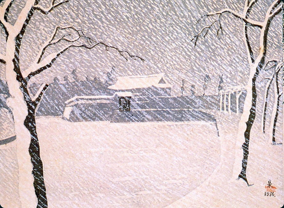
Snow at Sakurada Gate (#75), February 1936
“I wonder if it was snowing like this when Foreign Minister Ii was assassinated by loyal samurai from Mito?” (Koizumi’s annotation, 1940)
On March 24,1860 the high Shogunal official Ii Naosuke was assassinated at Sakuradamon (Sakura Gate) of the Edo Castle by masterless samurai formerly of the Mito clan, a group that strongly opposed Ii’s policies.
Link to Pathway 14: Memory & Memorials |
|
| |
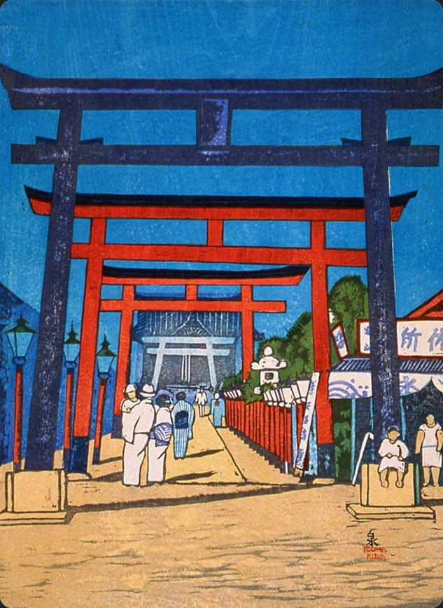 |
Anamori Inari Shrine at Haneda (#32), September 1932
“On the way home from shell gathering and fishing this is a good place to take a brief rest.” (Koizumi’s annotation, 1940)
Today this area has become parking for Haneda airport and this shrine was moved to a nearby spot.
Explore Pathway 15: Temples & Shrines |
| |
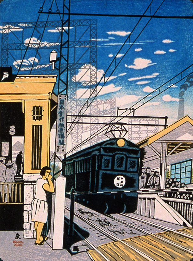 |
Togoshi Ginza Station (#27-revised), July 1940
“The steel towers at Ginza Station give an unusual contrast with the suburban setting.” (Koizumi’s annotation, 1940)
Koizumi’s fascination with new technology and its impact on the land and the people is evident in this suburban scene of a train stopping at the Togoshi station. An affirmation of Japan’s expanding economy, the new railway lines connected the suburbs to the commercial center in downtown Tokyo. The signboard promotes the Japan Creative Print Association, with which Koizumi was associated.
Explore Pathway 16: Transportation |
| |
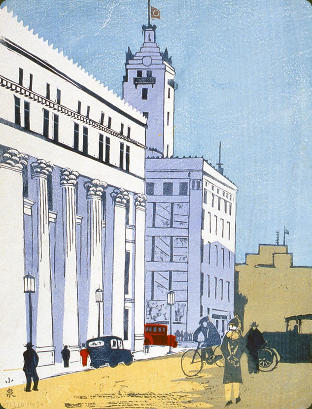 |
Mitsui Bank and Mitsukoshi Department Store (#3), April 1930
“I had heard that a single column on the façade of the Mitsui Bank cost 20,000 yen to build. This was also a time when red customer service cars were offered by Mitsukoshi Department Store.” (Koizumi’s annotation, 1940)
The completion of the Mitsui Bank building (at left), designed by the New York architectural firm of Trowbridge and Livingston, may have been the impetus for Koizumi's print. Tokyo's reconstruction as an up-to-date, international city eager to be on par with Western capitals such as London, New York, and Paris, is expressed by the bank's colonnaded façade in the European Beaux Arts tradition. The electric lamp posts and automobiles reinforce the impression of Tokyo's modernity. The Mitsukoshi Department Store (to right of bank) highlights Japan's adoption of Western-style commerce during the Meiji period (1868–1912). The building remained standing after the earthquake; it was reconstructed by 1927, with modifications continuing through 1934.
See places of professional enterprise in Pathway 17: Business Government Education |
 |
| |
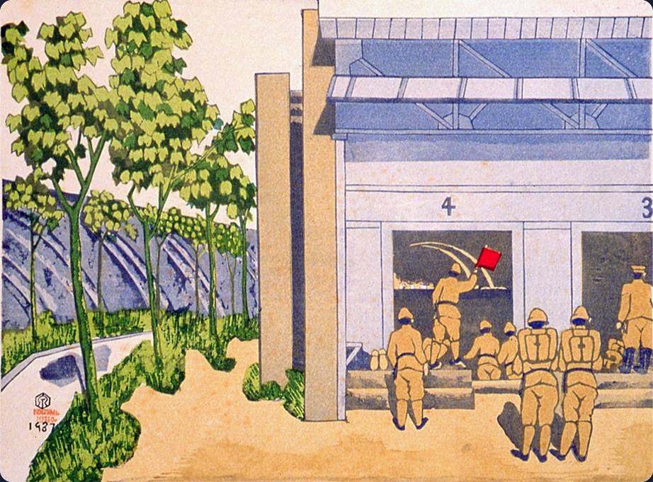
Army Firing Range in the Fields of Toyama [Ōkubo] (#93), June 1937
“This is where the elite Imperial forces are trained. The sound of live fire is thrilling.”
(Koizumi’s annotation, 1940)
This army firing range was a training ground for the military. When it was established in Ōkubo during the Meiji era, the compound was in the countryside. By 1937, however, Tokyo had incorporated large areas of the surrounding countryside, and high walls were built around the compound to shield civilians from the live munitions fire.
More military figures in Pathway 18: Military Presence |
|
|