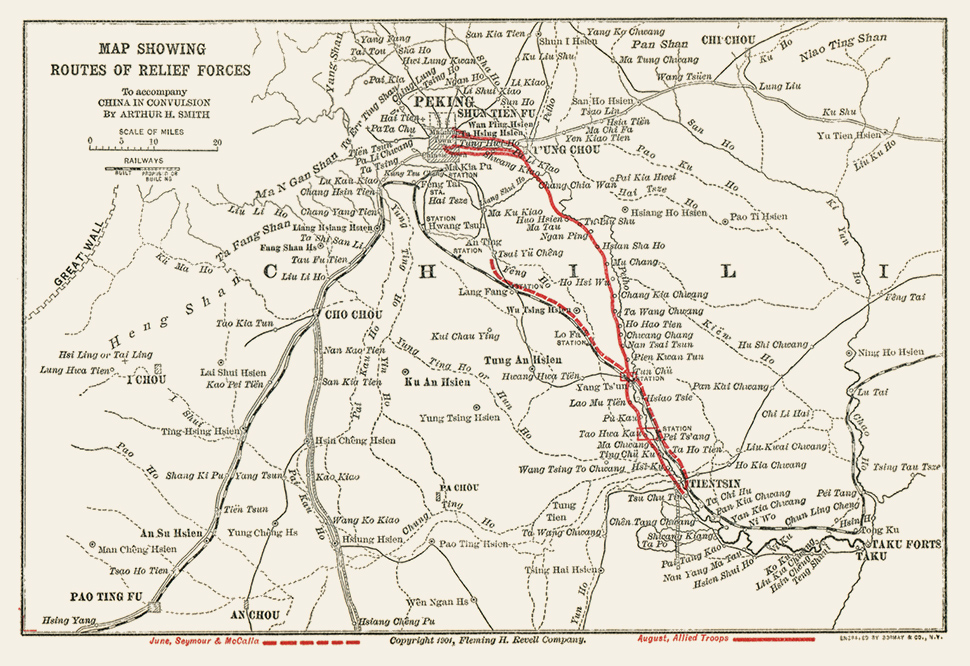
“Map Showing Routes of Relief Forces,” 1901 |
Roll over the map to see details. Legend: June, Seymour & McCalla – – [dashed line], August, Allied Troops — [solid line] Caption: "To accompany China in Convulsion by Arthur H. Smith [smith438a_maprelief] |
“From the Pei-Ho to Pekin,” 1900 |
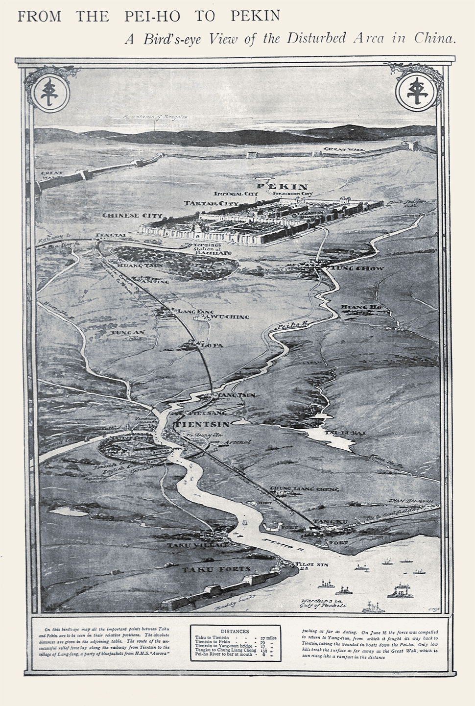
Roll over the map to see details. Caption: "‘A Bird’s-eye View of the Disturbed Area in China.’ On this bird’s-eye map all the important points between Taku and Pekin are to be seen in their relative positions. The absolute distances are given in the adjoining table. The route of the unsuccessful relief force lay along the railway from Tientsin to the village of Lang-fang, a party of bluejackets from H.M.S. ‘Aurora’ pushing as far as Anting. On June 16 the force was compelled to return to Yang-tsun, from which it fought its way back to Tientsin, taking the wounded in boats down the Pei-ho. Only low hills break the surface as far away as the Great Wall, which is seen rising like a rampart in the distance. Distances Taku to Tientsin - 27 miles Tientsin to Pekin - 79 miles Tientsin to Yang-tsun bridge - 17 miles Tangku to Chung Liang Cheng - 13 1/2 miles Pei-ho River to bar at mouth - 6 miles” Leslie’s Weekly, 1900 (vol. 90, p. 24) [leslies_1900_v90_2_024] |
On viewing images of a potentially disturbing nature: click here. |
Massachusetts Institute of Technology © 2017 Visualizing Cultures |